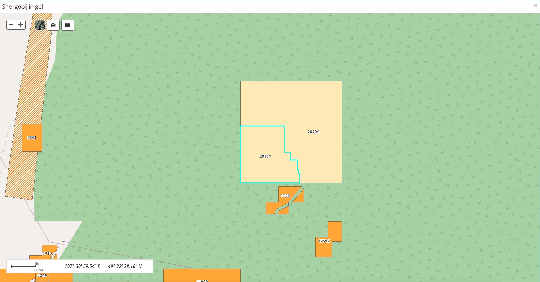
Shorgooljiin Gol
The award of a mining licence is pending decision in June 2021. MNO conducted a terrain reconnaissance with regard to mining in June 2019.
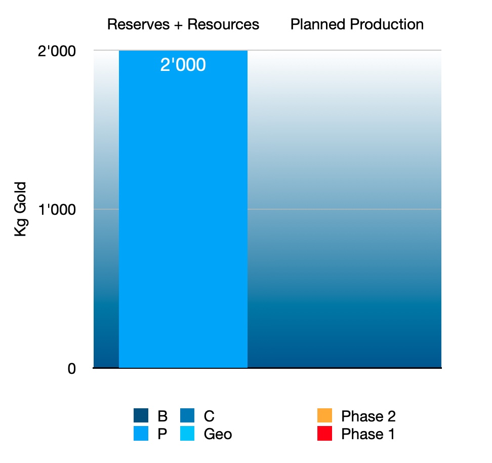
The placer reportedly holds some 2 tonnes gold.
The placer is located in a valley in the taiga in a cold and humid climate in Khuder Soum in northern Selenge, in the western North Khentii gold belt. Khuder and Darkhan are 25 km respectively 110 km and Ulaanbaatar is 190 km away as the crow flies. It is surrounded by a state-protected forest area.
Geologically the mine is located in the Lower-Middle Jurassic Orkhon-Selenge basin, on the Siberian tectonic plate which is bordered by the Mongolia-Okhotsk suture line in the South. This tectonic line marks the northward subduction and closure of the Mongol-Okhotsk ocean under the Siberian plate in the Middle Jurassic - Lower Cretaceous. The subduction caused the rise of the Andean-type Khentii mountains and the emplacement of magmatic intrusions which are associated with gold veins owing to the dewatering of the magma. Tectonics brought gold veins towards the surface, where they were exposed to the action of erosion and rivers deposited the gold elsewhere in valleys.
The placer gold of Shorgooljiin Gol is found in Quaternary river sands and gravels in the upper reaches of a very long linear valley characteristic of active strike-slip faulting. The placer lies within the Bugant-Yeroo placer district, one of the best gold placer areas in northern Mongolia. The gold content of the sands is reportedly very high.
Two active placer gold mines exist higher upstream in two side valleys.
Financials
We plan to mine the gold together with partners Sa Darma, Ulemj Alt and MNO. MNO will build and operate the mine. This placer is financially interesting because of its high quantity of gold.
A feasibility study and business plan must be made before the financial investment plan can be established.